
Columbia Previous Residents by Era
For a Columbia address history, begin with the time period, not a guess about occupancy. A current parcel record anchors a street address to a map and legal description. Deed indexes establish transfers. Directories and census schedules supply household clues for selected years. Sanborn sheets identify the form and use of a structure, while newspaper, cemetery, probate, and archival material can close a trail. None of these sources creates a continuous list of everyone who lived at a location, but together they can support a careful house or family history.
| Evidence source | Documented period | Columbia access point | What it can establish |
|---|---|---|---|
| Maury direct and reverse deed indexes | 1807 or 1808 through 1905 | Maury Archives and TSLA reels 193 and 199 | Grantor, grantee, index placement, and a deed-book lead |
| Digital Maury deed collections | 1807-1843, 1843-1877, and 1878-1891 | Maury ContentDM | Named roles, adjoining owners, and original record location |
| Columbia directory leads | 1925, 1948, 1950, 1953, 1956, and 1958 | Catalog and collection leads, verify shelf access | Household, address, and occupation clues |
| Federal census | Public schedules through 1950 | National Archives partners and library databases | Household composition, age, birthplace, and year-specific address fields |
| Sanborn maps | 1887, 1895, 1909, and 1914 | Library of Congress scans | Street layout, structure, materials, and use |
| Columbia One Stop permits | Current online span not stated | City online permitting search | Address-keyed permit, project, and case material |
Use a deed first when the goal is ownership. Use a directory or census checkpoint when the goal is a household. If an early record has only a tract or neighboring landowner, carry the legal description forward before trying to force it into a present-day number.
Columbia Parcel Records Before House History
Tennessee Property Assessment Data, known as TPAD, is the sensible starting record for a Columbia address. Select Maury County and search by property address, owner, or parcel identifier. Its advanced fields also include subdivision, sale dates, control map, group, and parcel. A result can identify the current owner, tax-year owner, situs or property address, mailing address, parcel components, sale information, and building characteristics. Preserve those fields before moving back in time.
TPAD can show a Jan. 1 owner separately from a current owner. Its mailing address is where tax correspondence is sent, not proof that someone lived at the Columbia property. The situs address identifies the parcel’s location. That distinction keeps an ownership trail from becoming an unsupported occupancy claim.
- Grantor
- The person or entity conveying an interest in a recorded deed.
- Grantee
- The person or entity receiving that interest in the deed.
- Chain of title
- The sequence of recorded transfers for the same land or parcel.
- Legal description
- The lot, block, subdivision, survey, tract, metes-and-bounds, or other land description that can survive a changing street address.
Note: Preserve the property address, parcel ID, control-map components, and legal description together before tracing earlier Columbia owners.
Columbia Ownership Records Through Deeds
The Maury County Register of Deeds records real-estate instruments and makes records available for public viewing and printing. The county page links TitleSearcher as its current online deed and lien route, but it is a paid service and no single online coverage cutoff is stated. The counter remains an important choice for a current copy, while Archives and TSLA are the documented route for early indexes and microfilm.
The Register of Deeds office page identifies the Columbia office and its access links.
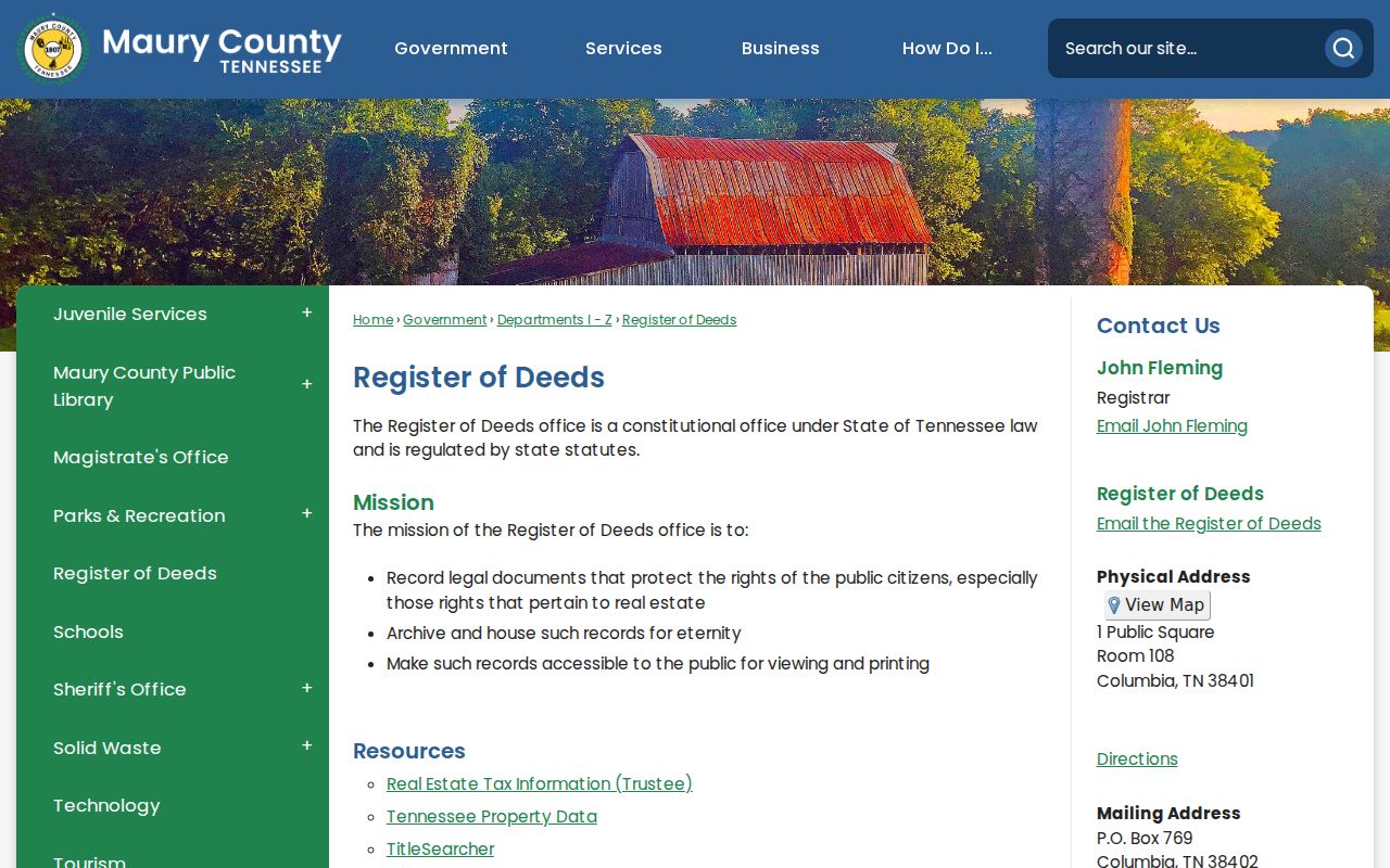
That office is where an index lead becomes a document request or a counter-viewing task, rather than a claim that a current web result covers every past owner.
- Record the TPAD current owner, street address, parcel details, subdivision or lot, and legal description.
- Find the current owner as grantee in the deed index, then obtain or inspect the purchase instrument.
- Copy the grantor, grantee, recording date, document or book and page reference, consideration if displayed, legal description, prior deed reference, and adjoining owners.
- Search that seller, the grantor, as grantee to find the earlier purchase. Compare its legal description before treating it as the same land.
- Repeat the process backward. When the trail reaches the historic indexes, use the Archives or TSLA microfilm instead of assuming an online gap proves no record exists.
A transfer can cover only part of a tract, join lots, or involve a trust, estate, or spouse. A matching surname alone is not enough. Parcel identifiers, a legal description, a spouse reference, and probate material can help test whether the record belongs in the same Columbia chain.
Columbia Historic Deed Indexes
TitleSearcher is the online vendor linked by Maury County for current deed and lien access. It is one access channel, not the full historical record. For the older chain, the Maury General Deed Index Direct and Reverse run from January 1808 through December 1905 on TSLA reels 193 and 199. Maury Archives also lists deed books, survey books, and deed indexes from 1807 through 1905. Those counter, archive, and microfilm routes matter when an address history predates a paid portal result.
The TitleSearcher entry screen is the county-linked paid gateway for recent deed and lien research.
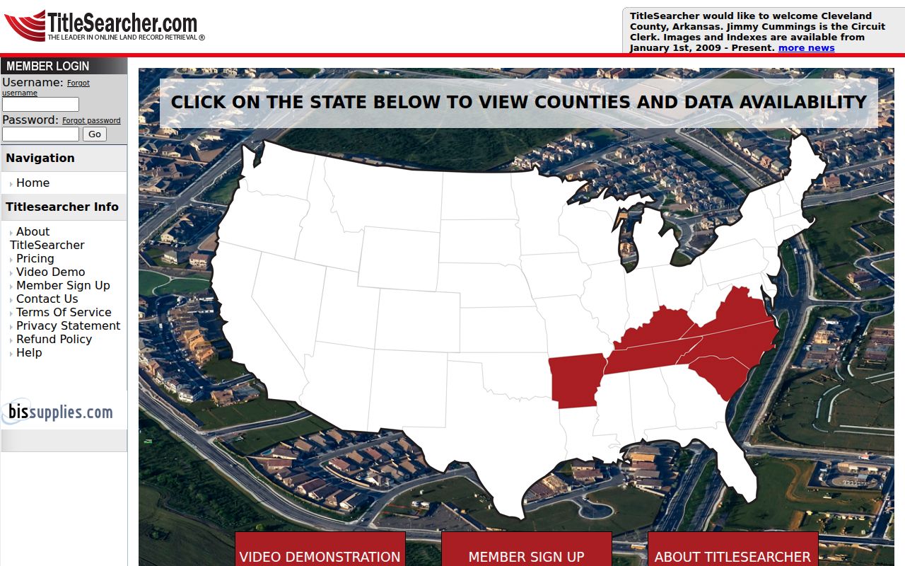
Use the vendor screen as a current-index starting point, then check the Register of Deeds counter or historical index reels when a time period is not documented online.
Note: A paid search result is an index lead. Read the recorded instrument and confirm the legal description before adding a person to a Columbia history.
Columbia Previous Residents in Digital Deeds
Maury County’s digital collections add a useful name-and-role layer to an early Columbia address trail. The 1807-1843 collection contains 12,566 deeds, the 1843-1877 collection has more than 16,000, and the 1878-1891 collection has more than 11,000. Collection metadata can identify people as grantor, grantee, adjoining owner, father, son, wife, or daughter, then point to the original deed location.
The Maury digital deeds collection provides the searchable historical collection landing page.
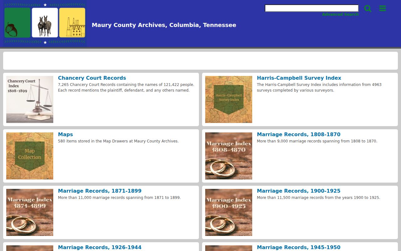
The role data can reveal a neighbor or family connection that an address-only search misses, but each hit still needs to be reconciled with the original instrument and later deed record.
That depth reflects Columbia’s early record history. Maury County’s first court session was held at Joseph Brown’s cabin on December 21, 1807, and early county record groups include deeds and wills from that founding period. Historic records are often more useful when names are followed through roles and land descriptions than when searched as a modern street number.
Columbia Household Records Between Census Years
Ownership is only one part of past residence. Columbia directory leads exist for 1925, 1948, 1950, 1953, 1956, and 1958, with a regional Polk lead for 1999 and Columbia and surrounding counties leads for 2003-2019. Exact local reverse or criss-cross runs were not verified, so ask the library or Archives for the year and shelf before depending on an address listing. The historical volumes themselves are described on the Columbia city directory page.
Pair the closest directory with the federal census instead of treating either one as continuous proof. The public census reaches 1950 under the 72-year release rule. Earlier schedules may name only heads of household, while 1850-1950 schedules can add household members, age, birthplace, relationship, and address information that varies by year.
- Search the old street spelling and nearby intersections in an address or telephone section, then test the alphabetical name section.
- Record the precise directory year, address, spouse or household notation, occupation or business clue, and any telephone entry.
- Match the closest available census year and compare ages, relationships, birthplace, and the address information available on that schedule.
- Use the deed date to distinguish an owner from a listed household, then test an obituary, probate file, or later deed if the household disappears.
A criss-cross directory begins with an address or telephone number and returns an occupant or name. Its exact Columbia year run remains a research gap, so it is a library or Archives question, not a promised online search.
Columbia Household Records in Archive Files
Maury County Archives’ genealogical research library provides on-site viewing or staff-search contact. Its vertical files include houses, historic sites, families, communities, schools, churches, cemeteries, and businesses. Special collections add maps and plats, building schematics, photographs, family papers, and organizational records. A dedicated fixed-fee house-history program was not documented, so contact staff for their current search and copy procedure.
The Archives genealogy holdings page shows the documented local research categories and microfilm leads.
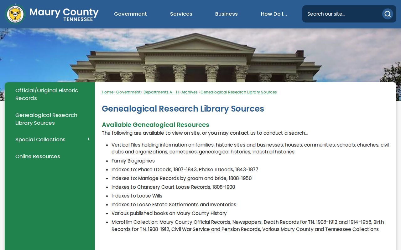
The Archives offers a practical fallback when a deed gives a tract description or an older Columbia address no longer matches the present street format.
Verified Sanborn holdings provide another structural checkpoint: four sheets in 1887, 12 in 1895, 24 in 1909, and 27 in 1914. They show a building’s form, material, use, and street grid, not a household roster. Combine a sheet with deeds and a directory, then use photographs or house files only as supporting evidence.
Columbia Address Records With Older Numbers
No official source located a citywide Columbia renumbering year, street-renaming list, or annexation readdressing map. Do not invent one. When an old number does not match a modern property, search the street name, nearby intersections, and historic-district or ward context. Compare Sanborn street geometry and preserve the deed’s lot, block, subdivision, survey, or metes-and-bounds language. Development Services or the Archives may be able to identify older plat or address records.
Columbia GIS receives parcel, address, and street datasets from Maury County while maintaining city layers such as limits, wards, historic districts, zoning, flood areas, and aerial imagery. Those layers provide context but are not a replacement for a legal survey or recorded instrument. A parcel reference and legal description are the more durable bridge across address uncertainty.
Note: A missing modern number is not evidence that prior Columbia residents were absent from the land or household record.
Columbia Previous Residents at Record Endpoints
Obituaries, cemetery lists, probate, and estate settlements often resolve the last part of a Columbia household trail. Maury Archives holds loose wills, estate settlements, and inventories. An estate deed may identify a next grantee, while probate can identify an executor or heir. Columbia cemetery lists and newspaper sources can supply a death date or relative name, but an obituary is a lead rather than a certified residence record. Verify each connection with the appropriate custodian or record image.
For a portal dead end, try an alternate spelling, the parcel identifier, a date range, the counter, or the documented archive and microfilm route. A Tennessee citizen may request an existing record from the right custodian under the Tennessee Public Records Act, T.C.A. §§ 10-7-501 et seq., but the office need not create a new list or identify a person from a vague description.
Lawful use. Columbia house-history research is appropriate for family history, estate questions, and personal curiosity. Tennessee law does not permit public records to be used to monitor, harass, or contact a living person repeatedly.