
Columbia ZIP Code Coverage
The Columbia ZIP code directory has two documented postal designations. ZIP 38401 is the standard street-delivery ZIP for Columbia and addresses around the Columbia service area. ZIP 38402 is a Columbia post-office-box ZIP. The available official research does not establish neighborhood lists, exact boundary polygons, box ranges, a ZIP split, or a special institutional ZIP. USPS, not a municipal map, is the verification authority for the complete delivery address.
| ZIP code | Documented coverage | Postal city | Research limit |
|---|---|---|---|
| 38401 | Columbia standard street-delivery ZIP and addresses around the Columbia service area | Columbia, Tennessee | May include addresses outside incorporated limits; exact polygons and neighborhood list were not located |
| 38402 | Columbia P.O. Box ZIP | Columbia, Tennessee | Not a residential street-area proxy; exact box ranges were not located in the USPS render |
Do not turn a Columbia ZIP code into a neighborhood, ward, or ownership boundary. A mailing city can serve an address beyond Columbia’s incorporated line, and a P.O. box code does not establish a physical street address. The complete USPS result and the county parcel identifiers serve different purposes and should be saved separately.
Columbia ZIP Postal Checks
The USPS ZIP Code Lookup has three documented modes. By Address requires street address, city, and state, with optional company, apartment or suite detail, and ZIP. By City and State requires city and state. Cities by ZIP requires a ZIP code. USPS warns that a ZIP result does not confirm a person or company at an address and cannot guarantee that a business address is the actual location. Add the unit number when several possible matches exist.
A postal result solves a delivery question. It does not reveal property ownership, voter registration, a court record, or a resident roster. Keep the input as precise as possible, including apartment or suite information where appropriate. If the returned postal city and the local map seem to disagree, check city limits through Columbia GIS and the parcel through Maury County rather than altering the address by guesswork.
- ZIP code
- A postal routing designation used to sort and deliver mail. It is not a city-limit boundary.
- ZIP+4
- An added four-digit delivery segment that narrows routing beyond the five-digit ZIP code.
- P.O. Box ZIP
- A designation used for post-office boxes, not evidence of a residential street-delivery area.
- Carrier route
- A postal delivery grouping used for mail handling. It is not a municipal district or a parcel boundary.
Columbia ZIP Search Fields
The local and state tools do not all treat a ZIP code the same way. USPS verifies postal information. GoVoteTN can accept a ZIP as an optional name-search narrowing field or as part of its address search. TPAD’s accessible advanced form does not present a ZIP filter, so it should not be represented as a ZIP-wide parcel search. It instead searches the underlying address, owner, subdivision, classification, sale date, and parcel fields.
| Official tool | ZIP-capable field or mode | Other observed fields | What the result is for |
|---|---|---|---|
| USPS ZIP Lookup | ZIP in Cities by ZIP; optional ZIP in By Address | Street, city, state, optional company and unit | Postal city and delivery-address verification |
| GoVoteTN | Optional ZIP with voter name; required ZIP with address search | First name, last name, street address | Polling place, sample ballot, districts, and elected officials |
| Tennessee voter registration lookup | No ZIP field observed | County, first name, last name, birth month, birth year | Named voter registration lookup |
| TPAD | No ZIP field observed | Owner, property address, subdivision, classification, sale dates, parcel | Property assessment and parcel research |
The observed distinction matters: a city or address-text search can be ZIP-adjacent, but it is not a documented ZIP filter. Likewise, a GoVoteTN address result supports election-location information, not a list of everyone in a postal area.
Columbia ZIP Search Workflow
Use a ZIP code as a narrow address checkpoint, then move to the record source that holds the fact being tested. The following order preserves the difference between postal, election, and property data. It also avoids treating a ZIP label as proof that a person lives at a given address.
- Enter the full street address in the USPS by-address mode and keep the returned ZIP with the exact address.
- For a polling-place or district question, use GoVoteTN’s address and ZIP route, entering the address as it appears on a registration card when possible.
- For a named voter-status question, use the Tennessee registration lookup with county, first and last name, birth month, and birth year.
- For a parcel question, search TPAD by the verified property address, owner, or parcel identifier, not by an assumed ZIP filter.
- When a ZIP narrows the area to a street, use the Columbia street directory for the address-keyed property and deed workflow.
Columbia’s Election Commission can address a registration-status problem when the portal returns no record. The office is at 1207A Tradewinds Drive, Columbia, 931-375-6001. For existing county records, Tennessee citizens may use the Tennessee Public Records Act request route with a specific custodian, but the law does not require an office to create a new ZIP-wide people list.
Columbia ZIP GoVoteTN Results
GoVoteTN gives Columbia users two distinct entry paths. The voter route accepts first and last name with an optional ZIP. The address route accepts street address and ZIP. The documented result uses are sample ballot, polling location, elected officials, and district information. The application states that its information comes from local county commissions and does not contain property-rights voter information.
The GoVoteTN search screen shows the ZIP and address controls available for Columbia election questions.
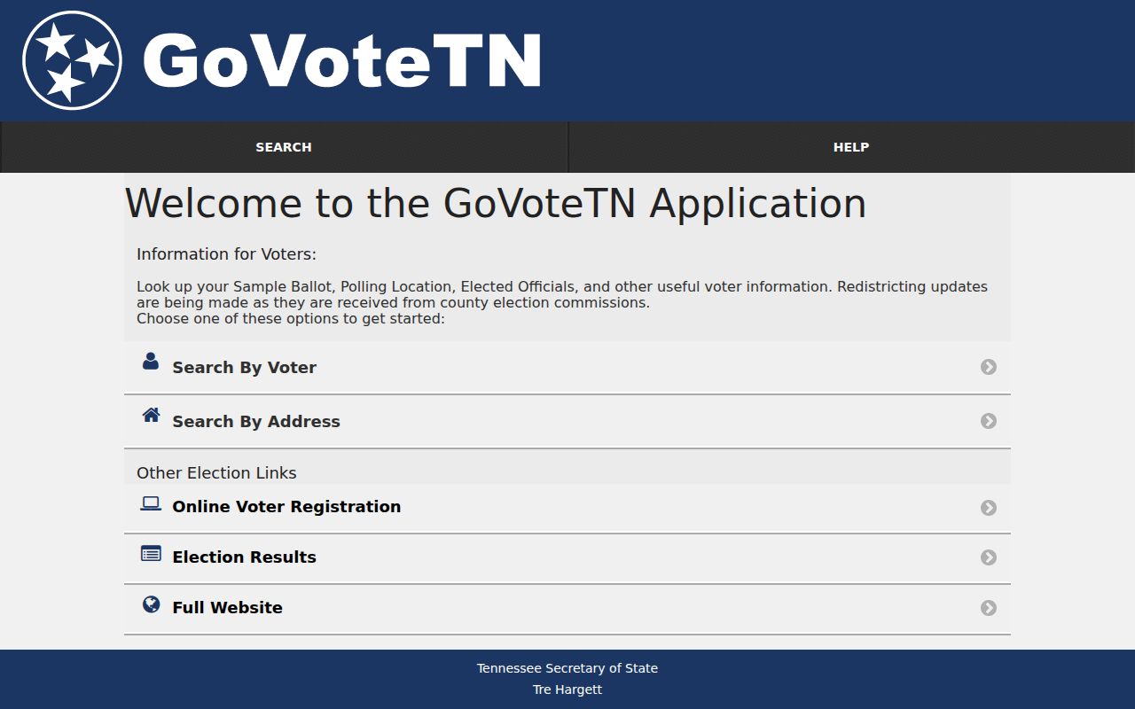
The image is evidence of the search choices, not proof that a ZIP field can return a resident list. Tennessee registration records exclude Social Security numbers, driver-license numbers, and Department of Safety identification. A bulk voter list has a separate statutory process and political-purpose certification, so the ordinary lookup should not be repurposed as an area roster.
Maury Records After a Columbia ZIP Check
Once the USPS result identifies a delivery address, use TPAD for Maury parcel research. The portal can return owner, tax-year owner, mailing address, situs address, map, group, parcel, lot, class, sale information, and assessment data. The mailing address is not the same as the property location, and either one can differ from a voter or postal address. A tax owner is also not automatically an occupant.
Columbia’s GIS Mapping information says the city receives parcel, address, and street datasets from Maury County and manages layers for city limits, wards, historic districts, zoning, flood areas, and aerial imagery. Use a map click as a way to find the parcel identifier or local context, not as the legal boundary. The current map tools did not provide a verified ZIP boundary layer in the accessible research.
For a more complete property trail, save three kinds of identifiers: the street or situs address, TPAD’s control-map/group/parcel ID, and the legal description or deed book reference. The postal designation is a fourth identifier. Keeping all four prevents a later mismatch from being mistaken for a change in the underlying parcel.
A parcel query can return a Columbia mailing address, a property address, or both. Compare the spelling and directional parts of the street with the USPS result before searching a deed or map. When the records differ, retain each source’s wording and date. The difference may reflect mail delivery, assessment timing, an owner’s mailing preference, or a data correction rather than a change to the parcel itself.
Columbia ZIP Areas and City Limits
Columbia postal boundaries and Columbia municipal limits describe different geography. The official city GIS and city information are appropriate for incorporated limits. USPS assigns delivery routes. As a result, a 38401 mailing address can be outside Columbia’s incorporated limits, and a city-limit parcel can have a postal arrangement that does not match a ward, historic district, or a reader’s expected neighborhood label. The accessible sources do not supply a single citywide street-numbering rule or a verified postal-boundary map.
Do not infer a past street renumbering, annexation readdressing date, ZIP realignment, or split from a mismatch. No Columbia-specific year for those events was verified in the research. For a historic address, compare street names and landmarks, Sanborn street geometry, historic-district maps, and archive or Development Services records.
Columbia ZIP Areas and Wards
Columbia has five wards, and the city GIS includes ward data, but wards are civic representation geography rather than postal, owner, or parcel boundaries. A person may need a ward map for a council or local-government question and a ZIP for delivery or GoVoteTN address entry. Those are both valid questions, yet they use different official datasets and should not be joined without checking the address in each one.
District information can change. The Maury Election Commission notes that congressional redistricting affected approximately 19,662 Maury addresses in its current map notice. Recheck the official election source for a current district or polling-place question instead of copying a prior ZIP-based result. Note: Postal confirmation is useful, but it never replaces a current election or city-limit lookup.